We are taken by surprise on Tuesday's drive over Red Mountain Pass, looking for some new "dots" to add to our grid. Autumn colors are about to peak, earlier than usual by a week or more. Even though it happens every year, the kid in me can't help feeling it's brand new.
Recall the hike to Paradise Basin a few posts back. Upon our return to the car we drove on up toward Ophir Pass Road another half-mile or so and took a lesser road that we had yet to explore. Our map showed it would come to a dead end, but while exploring we noticed a roadside cairn that marked an ever-so-slight trail cutting upslope through Ms Autumn's golden tundra.
Bobbie and I have heard rumors from secretive climbers regarding a backdoor route over the seeming mountain impasse between Ophir Pass Road and Columbine Lake. We've looked for possibilities from both sides...allways to no avail. The terrain is just too rugged and steep for geezer-types. So it was with low expectations that we explored the little tundran trail in search of the "rumored" breach in a range of surly mountains that soar to over 13,500 feet.
 |
| Gazing across to Paradise Basin, "Dots" now filled in. |
 |
| Signs of fall |
 |
| Another look at Paradise Basin |
 |
| As with Paradise Basin, we stepped off on what appeared to be little more than a game trail. We were heartened by occasional cairns which we took as a "sign" that "this trail goes somewhere." |
 |
| Somewhere on the other side of those mountains lies blue, blue Columbine Lake |
 |
| Oh to breach those mountains... |
 |
| We stumbled upon a family of Sage Grouse. |
 |
| Then got back to work on our mysterious secret trail. |
 |
| Abundant Fire Weed going to seed |
 |
| Bobbie hiking what had become a barely visible trail with Paradise Basin in backdrop. But note the cairn; this trail goes somewhere! |
 |
| A-ha! |
Optimism grew when our trail took a turn toward a hidden basin. The above saddle and ridge looked familiar. Checking the map we discovered that we had traversed it years ago, right-to-left, on our way to T-11, a 13er that overlooks Columbine Lake. Now I'm getting excited, because if nothing else that tundra slope to the saddle appears doable!!!
Indeed, the hidden basin held a hidden lake, and yet another (we think) "doable" route to another saddle.
We plopped down next to the lake, eyeing our two options. To our right was a slope of tundra that we could zigzag up to a saddle and ridge that we know leads to T-11 and a view of Columbine Lake. But across the lake lay a more direct route to a saddle on the other side of T-11, one that we calculated might land us directly above Columbine.
Now, when given an ascent choice between tundra and scree, always choose tundra! It grows in clumps that resemble stairs, and allows one to "step-by-step" their way up the steepest terrain in relative safety. Then again, taking the tundra route meant we would have a half-mile of bouldering in order to get ascend T-11, which was a route we'd already done. No new dots there!
"So," I proposed to Bobbie, "If someone held a gun to your head and said 'choose your poison,' which route would you take?"
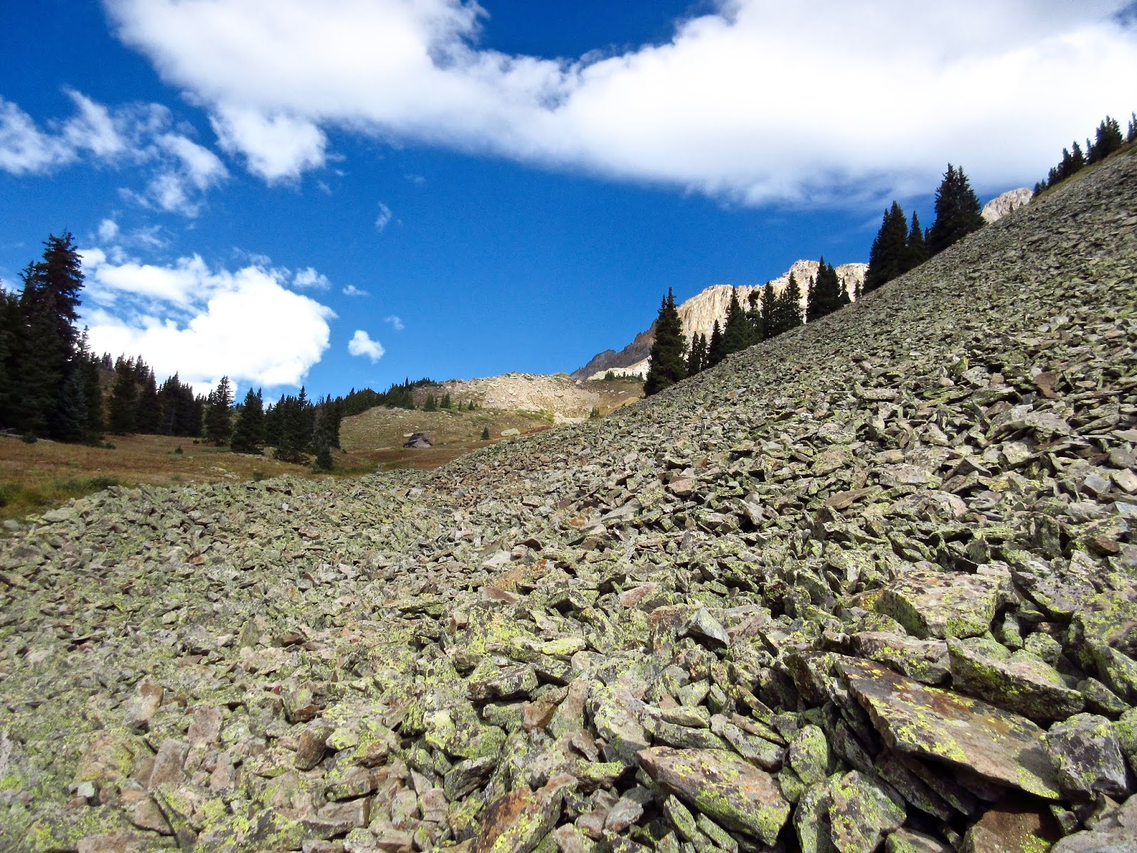
She looked back and forth between the two options. "I guess I would choose the scree because it's more direct and 'unknown.' But it could be steeper than it looks...not sure we can make it."
Well, we won't know if we don't try...
 |
| Lord God, scree from Hell! |
Stay tuned for Part II.
Peace out,
mark and bobbie


Good God......you are getting the Pulitzer Prize for Best Mountain Hiking Blog on the Planet....gotta find you some financial backing and a Publisher!
ReplyDeleteThanks for making our morning. :)
Being that we are not in your league of hiking we'd probably have taken the Tundra.
ReplyDeleteYou two are part Mountain Goats.
Be Safe and Enjoy!
It's about time.
This all looked like lovely fun until that last photo!
ReplyDeleteOne of my favorite things in the world is finding a new-to-me "secret" trail! You two are hitting the jackpot here. However, I do know that scree can stop the strongest hikers/climbers so I am looking forward to part 2. Gorgeous photos.
ReplyDelete