
A couple days after healing up from my Hike-a-Bike fiasco, I climbed back in the saddle...vowing to stick to familiar roads and trails. Of course route vows, unlike marriage vows, are written in sand instead of stone.
This time out I exercised moderation for a change. In other words, I pretty much knew where I was...most of the time.
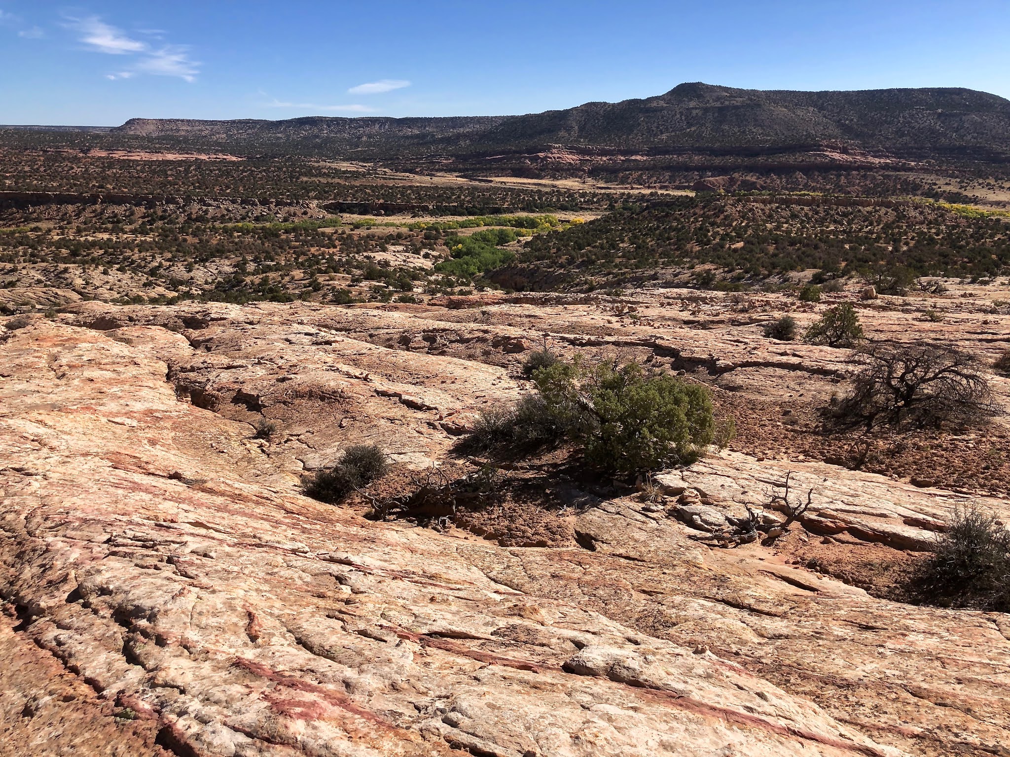
I wove together a route that landed me on the sandstone exit from the canyon cliff dwelling mentioned and shown a couple posts ago. I remember thinking that it would be a fun place to play around on a bike, with the extreme traction it affords as well as built-in obstacles to negotiate.
 |
| Playing on sandstone |

Another sun blistering day with temps in the upper 80s, it didn't take long to shred legs and melt ambition. I ditched my bike under a cedar tree and wandered off downhill on foot, just to see where I ended up. Following a colorful drainage that seemed to be deepening with every step, I discovered a little pot-o-gold at the end of a sandstone rainbow...a demure natural bridge, carved by Nature's ultimate solvent, water!


The bridge was perched on the edge of a pour-off above a cavernous, cottonwood-filled canyon. A few more steps revealed more "gold," a collection of south-facing alcoves, most of which had been occupied by The Ancients. I plopped down and pulled binoculars from my pack in order to get a better look at the shadowed interiors.


While glassing various ruins and alcoves, I heard people talking. Huh, standing just a few yards away a group of people stood at a signed overlook. Beyond them were bits a pieces of a short trail that wound up from a parking not far off highway 95. That would be an easier way, for sure.
I tried to remember if I had been to this ruin before. My Bobbie App would know, but she was still back home in Lovely Ouray. After the tourists headed back to their cars, I walked over to take a look at the sign. From that vantage point I saw evidence of "construction" in several alcoves. COOL!
Across the canyon, a couple of young gals with a little dog were wandering around the dwelling sites. It was getting hot, hot, hot out on the reflective white sandstone, and I was miles and miles from camp...mostly uphill (Ugh).


 |
| Playful gnome-like figurines on the way back to my bike |
A few days later, Bobbie rolled into camp. "I've got so many things to show you!"
The next day I took her on an 11 mile back country loop-hike that included the interior canyon cliff dwelling, the natural bridge, and the multi-homed Butler Wash complex near Highway 95...

 |
| The entry to the Canyon Cliff Dwelling is well hidden, and steep. |
 |
| Canyon cliff dwelling, so worth the effort. |

 |
| Getting out of the canyon, however, is a little sketchy... |


A few days later, Pal Chris rolled into camp. "Boy do we have a trifecta of ruins hike planned for you!"


 |
| Bobbie and I have been here several times but never noticed the petroglyphs till Chris pointed them out. |


Time to move on down-canyon, climbing up to inspect every promising alcove for "treasures."


Soon, Curious Chris led us up and out of the canyon to wander a new route around a pour off.

After the pour off, the canyon plunged in depth and the walls closed in. We followed the rim, looking for a way down that didn't include ropes. "I don't think we can get down from this side." Don't tell that to Chris, though. "There's always a way."
 |
| We're stuck on top, looking down at Chris as he explores a sketchy route back down into the canyon. Of course he finds a way, but it's kinda "snaky," as in "rattle snaky." |


Then on to the hidden canyon cliff dwelling, where Chris found more petroglyphs that we had overlooked.


Then up and out of the canyon to take a slick rock walk to Butler Wash Ruins (again)...as shown in photos above. Hey, I never get tired of hiking, and Chris has not been here before. An 11 to 12 mile day, all in all. But the best is yet to come...
Peace out,
Mark, Bobbie, and Chris.
Gorgeous landscape! Wow, what an epic hike. Of course Dad picks up on the petroglyphs. By the by...I think your birthday just passed, I know yours is just before mine. So, HAPPY BIRTHDAY FRIEND!!!!
ReplyDeleteBack at you with the happy B-day wish. We sure had fun hiking with your dad, and he was good at finding "art" that we had never seen. Wish you could of joined us...that's a cool area with few people.
Deletemark
Nice, not counting the cover, photo #4 looks like a skull face, eyes and nose.
ReplyDeleteThanks for answering lots of questions we have always asked when passing thru that S E area of Utah Mark, it's too bad it is always so dam warm no matter the time of year it seems. Love the Cliff dwellings and to find some that are off the beaten path and more isolated must really be extra special.
ReplyDeleteNow what about Mt. Pennell, only 11 thousand feet, and I see what look like hiking trails to it.
Hey we had our lst rain shower of the season today, just hope we have a record year, hell I don't care if it floods here, the more better off the earth would be.
Stay Thirsty My Friends
D & A
Thanks Mark! Love pics and especially the header of your bike. It’s just beautiful!
ReplyDeleteCool!! Hey Mark did you change your font style? I don't like it :(
ReplyDeleteI know!!! It's blurry. This stupid new blogger changes fonts and font sizes on every post and I have to go back in, find the problem, and undo it. Grrrr. I'll get too it soon...having too much fun outside right now. Today is a moving day...dodging cold fronts and wind. Wonder where we'lll end up???
DeleteThanks, Mark
There, how's that??? :)
DeleteDid you get to Monarch on the east side? We once drove the Navion north from 163 on the 262 to the BLM CG off 95.
ReplyDeleteSeveral other hikes along this route. Love the photos!
Not this time, but was there a few years ago. Lots of corn cobs and pottery shards.
DeleteThanks once again for being the guide to some cool new places. It’s always a joy to explore with you guys. Chris
ReplyDeleteLove the header photo(Expert Masons). Wish we could have met up. Miss you guys! -scamps
ReplyDeleteThat would be sweet...maybe next year, in March :)
Delete