There are more than a few mountain mine locales that Bobbie and I frequent...scratch our sweaty brows in wonderment at how miners managed to cart hulking, cumbersome pieces of heavy equipment up to their hard-rock digs. One of the more astounding examples of this is Grizzly Mine, with its improbable narrow access literally etched into the cliff-face above Bear Creek. You'll find this trail less than five miles south of Lovely Ouray on the infamous Million Dollar Highway...another etched-in-a-cliff-face wonder, as in "How in the Hell?"
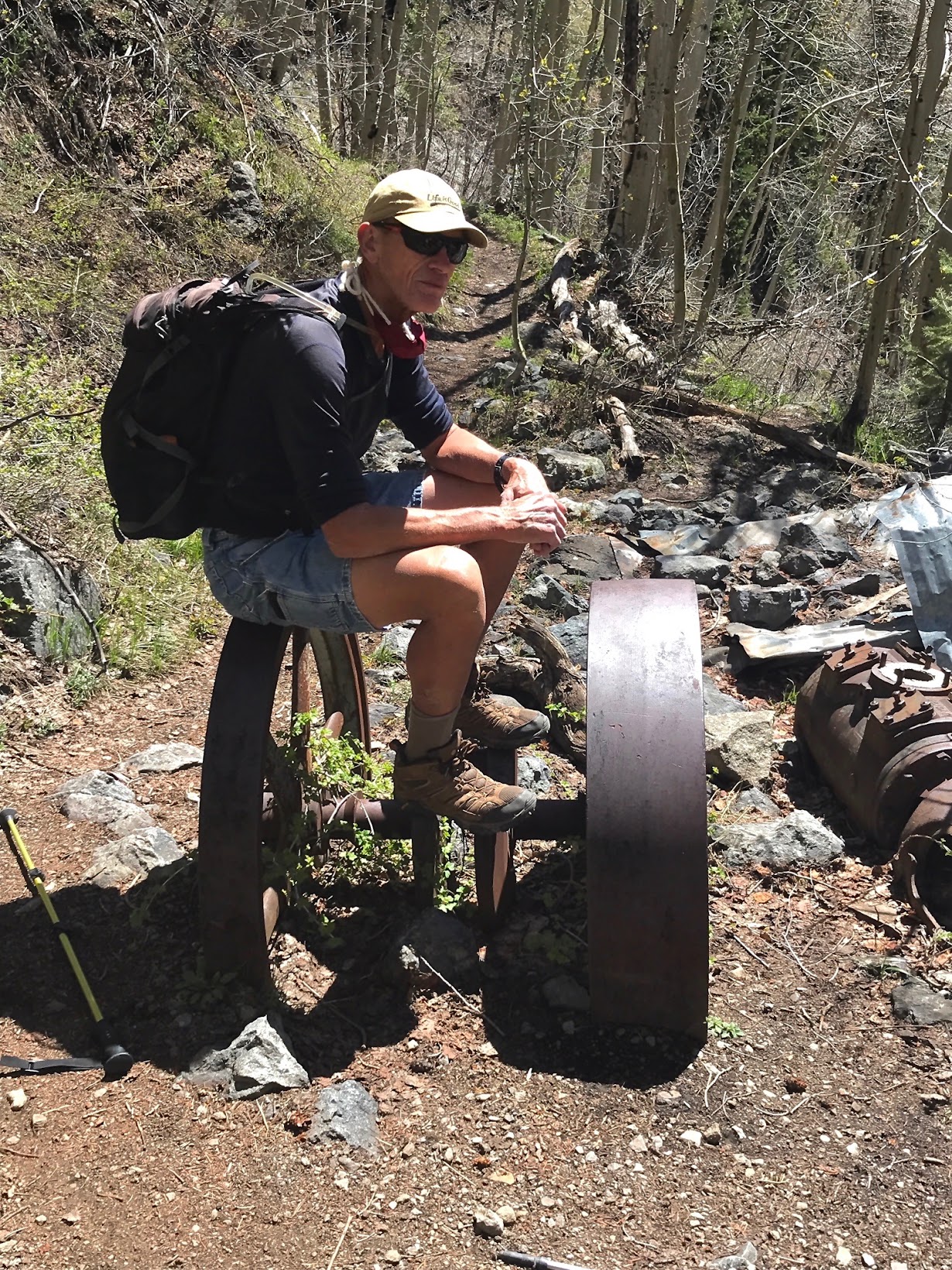
One thing for certain: when you gaze at the size and amount of heavy steel mining equipment scattered about Grizzly Mine, you'd bet your next paycheck that it didn't arrive via the same precipice trail that brought you. Yet it's there, huge immoveable motors, pumps, tanks and flywheels, scattered like a bomb went off. We've always wondered, "How did they get that shit up here, anyway?" And now we know...
But first, the hike.
Beyond Grizzly Mine a couple of mile lies another mine that goes by the name Yellow Jacket, and it was our anticipated destination.
The Bear Creek Trail to Grizzly and Yellow jacket Mines begins as a series of forested switchbacks up the side of a mountain. The trail is mostly comprised of beautiful slate and shale that clinks underfoot like you're walking across broken china.
But early starts casts the slate and cliffs in shade, detracting from its color. Not in shade is the sunlit, snowcapped Hayden and Whitehouse massifs cross valley that vie for attention and photographs. What slate?
After a few switchbacks, Ouray's sentential pyramid Mount Abram steals the view, a wonderful summit best reserved for late June. And let's not forget several switchback bird's-eye views of Lovely Ouray, as it shrinks from view.
 |
| Mount Abram, 12,800 feet |
 |
| Lovely Ouray and beyond to Pleasant Valley, as seen from Bear Creek Trail's switchbacks |
Bear Creek Trail can have a few precipitous spots as a result of the erosional effects of winter. But nothing that careful foot placement can't overcome...till later, we soon learned.
A few shots from Bear Creek's switchbacks...
 |
| Hiker Babes, Bobbie, Ruthie, and Bridget |
Once in the canyon, Bear Creek Trail becomes more...uh, interesting and dramatic.
 |
| Grizzly Mine, with some of its associated heavy mining equipment. It begs the question: How did they get it up here? |
Grizzly is a good spot to take a break and ponder how such a collection of heavy equipment made it's way here...not to mention all the lumber and roofing for the, now mostly collapsed, buildings that housed workers?
After our hike, Bobbie went digging for answers. She found some clues in a couple of books about mining history. The answer? Well, you would never guess...
Early History of mining in Bear Creek Canyon
From Mountain Mysteries, The Ouray Odyssey, by Marvin Gregory and P. David Smith.
"Bear Creek Trail is an extremely exciting...hiking trail. The trail was originally on the (north-facing) south side of Bear Creek and was one of the principle routes on horseback or by foot from Ouray to Lake City...The present trail winds up through (forest) into a (scree) of slate and shale...The trail levels out at about 9,400 feet. The next mile is the "hairiest" part of the trip as there are 700 to 800 foot drop-offs, and slides have...made the trail extremely narrow."
Mines located on the south (north-facing) side of Bear Creek were plagued by avalanches that even claimed lives of miners back around the turn of the last century (1900). Grizzly Mine opened in1875, and quickly reached "peak production." In 1896 the Grizzly was sold to George Hurlburt, who moved its access trail to the south-facing (sunny) side of Bear Creek, at a cost of $8, 642.09. Yeah...down to the penny. Moving the trail to the sunny side made it more passable for longer periods through out the year. Hurlburt then generously sold the trail to Ouray County for $2500. A small town of 24 residents (1900 census) popped up near the trailhead.
Though collapsed, a sizable boarding house for miners now lays in ruin across the creek from Grizzly Mine...no doubt flattened by avalanches and heavy snow. A bridge was constructed across the creek for mine access.
Fast Forward, to the 1980s and 90s
From History of Ouray...A Heritage of Mining and Everlasting Beauty, by Doris H. Gregory: Copyright 1995
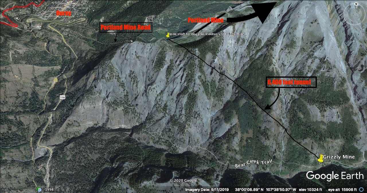
"One of the mines currently producing near Ouray is the Savage Mine Company located in the Ohio Park area of the Amphitheater near Portland Creek...Exploration work started in 1980...(with) the aim to complete a 6400 foot (tunnel) to gain access to the area of the old Grizzly Mine...The tunnel was completed in February, 1994.
Ok, this was no small feat. Imagine the cost? But the owners/partners of the Savage Mine maintained their belief that there was more gold and silver to be had in the Grizzly area...if they could just get the equipment there to mine it.
Hence "The Tunnel," nearly a mile and a quarter long, from the Amphitheater above Ouray, through the belly of a mountain to the Bear Creek drainage and Grizzly Mine. Now there was a way to get the heavy equipment needed to mine Grizzly on site!
The maps below will give you a Google Earth view of the enormous feat that Savage Mining Co. pulled off in order to get equipment where they needed it. Note: There is a road to the tunnel above Ohio Park.
As far as we can tell, given the rust and decay surrounding Grizzly Mine, the "gold" didn't pan out...at least not yet.
Pan →
Ok, back to our attempt to hike beyond Grizzly to Yellow Jacket Mine...
Following a winter's worth of erosional snow-slides and spring snow-melt, there's a short section of trail just beyond Grizzly that can thwart best laid plans to get to Yellow Jacket. This section of trail has to be rebuilt nearly every year where it crosses a highly eroded slide area. Though I failed to take photos, trust me...the slope is steep, and it aims right for a substantial drop-off into Bear Creek. One slip, and there would be no stopping, at least not without an ice ax to plant into the slope's hardpack.
I studied the crossing while the Hiker Babes caught up...even tested the first couple of steps. NOPE. It was too slick...a skim of powder sand over hardpack dirt. I recalled that Bobbie and I have crossed this nasty section before, a couple times, actually. But only when there was a small etch of trail leftover. It was frightening. The slide and drop into Bear Creek would, at the least, severely maim or at worst, snuff out your life. To boot, there is no cell signal way back in that canyon. Rescue and/or medical attention would be a long time coming.
By the time the gals caught up, I thought I had spied a route higher up that might get us across the slide area, one that would at least give us more time to arrest a fall, should it happen.
We agreed to give it a try, which required climbing up to a higher route in order to access the new crossing. But sometimes hillsides are steeper than they look. This was one of those times.
We were clinging to a mixture of grass and thorn bush, trying to work our way up a dry-slick slope that was every bit as steep, if not steeper, than the slide itself. As I stopped to catch my breath and wipe thorn induced blood from punctured hands, I noticed how precarious the slope was. The gals were strung out, moving slowly with only a distant Bear Creek to break a potential fall.
Shit. This is exactly what we should NOT be doing during a pandemic that has rescue and medical services already stretched beyond limits....
After considerable effort and risk, the upper crossing was a bust. I promised we would return in a couple weeks when the creek flow was down, maybe cross to the other side and regain the trail to Yellow Jacket. But not today...just not worth it.
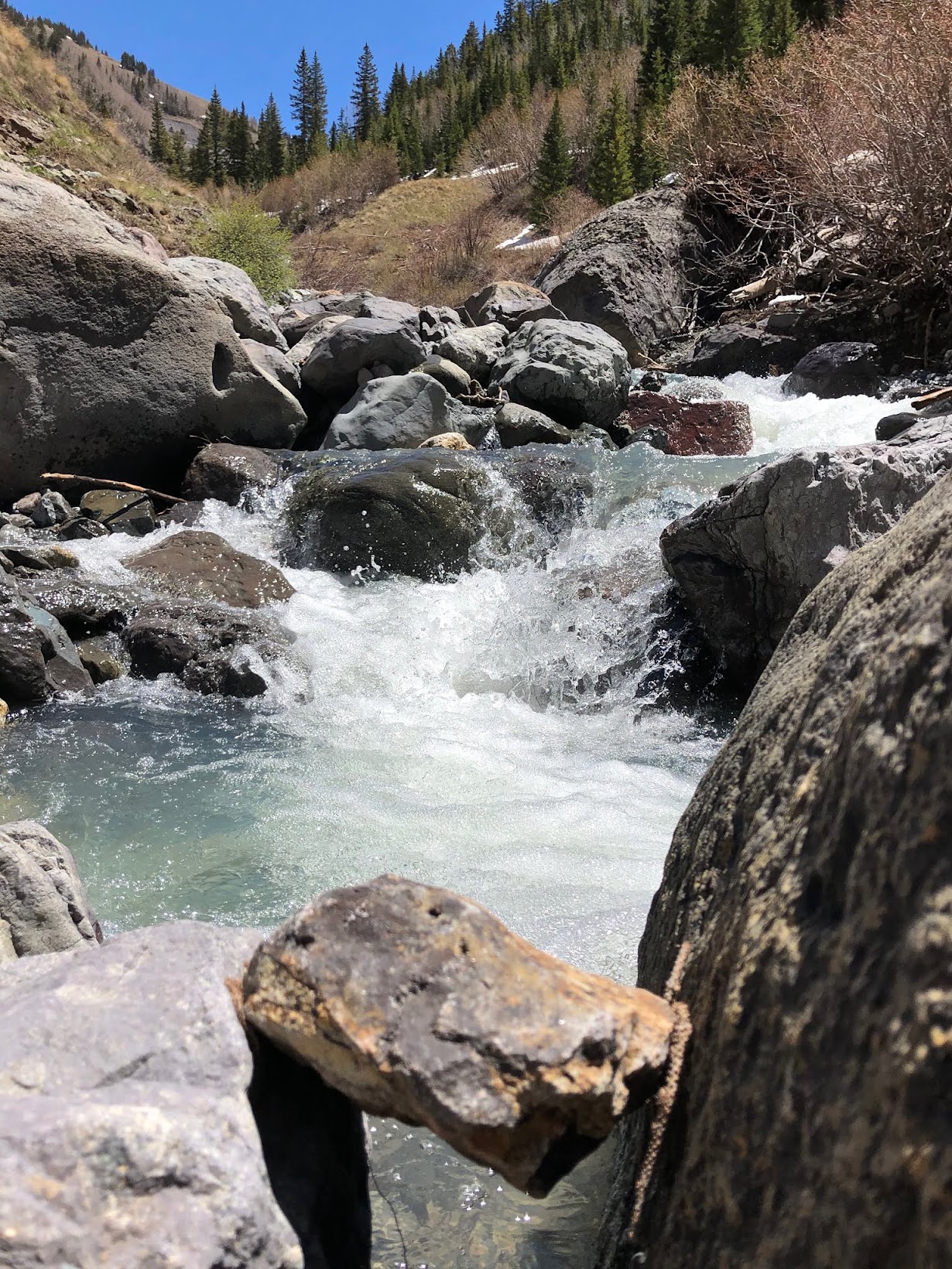
We stopped at the creek for rest and refreshment (and to let my legs quit shaking). We listened to the rushing water, gushing toward the Pacific miles and miles away. With at least 5 dams between here and there, it could take years.
 |
| Bridget...properly social distanced |
 |
| Bobbie and Ruthie |
Time to head home..
Afternoon sun lit the rocks on fire...beautiful color and pattern...
Another hometown hike in the books.
Peace Out, beautiful people!
Now get outside and enjoy our beautiful niche.
Mark and Hiker Babes, Bobbie, Bridget, and Ruthie.


Dam if I knew you were going pass all those gorgeous rocks , like the ones under the description late afternoon sun , well hell you could of had brought me a couple of beauties for my new rock garden :) :)
ReplyDeleteDam that was another spine tingler , but the rushing sounds (I can only imagine)of Bear Creek rushing down thru the canyon was so romantic, they always get my imagination going and dream of living the Mountain Man life and drinking from that water source . God I was born too late......but who would want to have missed the 60's , California Dreaming 😀
Stay Thirsty My friends.......well you got a good drink this day.....I didn't see any bear scat on the trail ..so no worries
D & A
Wow!
ReplyDeleteThat's amazing they blasted a tunnel through that mountain! Too bad it seems not to have been worth it.
ReplyDeleteYou guys are hardcore!!!
Thank you!
ReplyDeleteGorgeous rocks indeed! and the trail home was beautiful, relaxing and stress-free too for us blog fans :)
ReplyDeleteThat was really interesting. And soooo gorgeous! The light there is so brilliant and pure. Just beautiful.
ReplyDeleteThanks so much for this post! We hiked the trail to Grizzly today, and kept scratching our heads wondering how in the world did they get this stuff up here??!
ReplyDelete